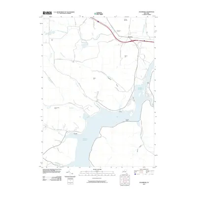
2010 Map of Steamburg
USGS Topo · Published 2010About this map
The Allegheny Reservoir dominates the southern landscape of this 2010 survey, illustrating the managed water system that reshaped the valley south of Steamburg. This modern topographic record captures the area as a recreational and conservation hub, where the reservoir's fingers reach into drainages like Bone Run and Sawmill Run. To the east, the boundary of Allegany State Park encompasses high ground such as High Peak, while the western hills are marked by rural settlements like Carr Corners and specialized sites like Coles Landing Airport. Local history is anchored by the Oldtown Cemetery near the shoreline and the Steamburg Cemetery to the north. The map traces the transition from the flowing waters of Little Conewango Creek to the still expanse of the reservoir, providing a clear view of how public lands and hydro-projects have defined this corner of New York.
Find a feature on this map
53 named features on this map. Tap any name to fly to it.
Don’t see what you’re looking for? This feature index may not catch every label — zoom into the map to look around manually.
Map Details
Editions of this 2010 Steamburg Map
This is the sole edition of this map. No revisions or reprints were ever made.
Other maps of this area

1905 · Jamestown
USGS Topo · 1:62,500

1906 · Warren
USGS Topo · 1:62,500

1907 · Warren
USGS Topo · 1:62,500

1908 · Warren
USGS Topo · 1:62,500

1922 · Randolph
USGS Topo · 1:62,500

1923 · Randolph
USGS Topo · 1:62,500

1936 · Kinzua
USGS Topo · 1:48,000

1941 · Kinzua
USGS Topo · 1:62,500

1942 · Jamestown
USGS Topo · 1:62,500

1943 · Randolph
USGS Topo · 1:62,500