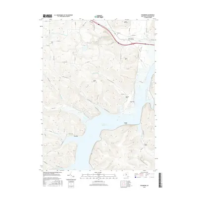
2016 Map of Steamburg
USGS Topo · Published 2016About this map
The Allegheny Reservoir dominates the southern landscape of this Cattaraugus County region, a large body of water that transformed the local geography. The settlement of Onoville sits along the western shoreline, while Steamburg remains a primary hub further north near the Steamburg Cem. The terrain is defined by a series of significant elevations including Pine Hill, Round Top, and High Peak, with numerous deep hollows such as Hotchkiss Hollow and Browns Hollow cutting through the uplands.
Find a feature on this map
65 named features on this map. Tap any name to fly to it.
Don’t see what you’re looking for? This feature index may not catch every label — zoom into the map to look around manually.
Map Details
Editions of this 2016 Steamburg Map
This is the sole edition of this map. No revisions or reprints were ever made.
Other maps of this area

1905 · Jamestown
USGS Topo · 1:62,500

1906 · Warren
USGS Topo · 1:62,500

1907 · Warren
USGS Topo · 1:62,500

1908 · Warren
USGS Topo · 1:62,500

1922 · Randolph
USGS Topo · 1:62,500

1923 · Randolph
USGS Topo · 1:62,500

1936 · Kinzua
USGS Topo · 1:48,000

1941 · Kinzua
USGS Topo · 1:62,500

1942 · Jamestown
USGS Topo · 1:62,500

1943 · Randolph
USGS Topo · 1:62,500