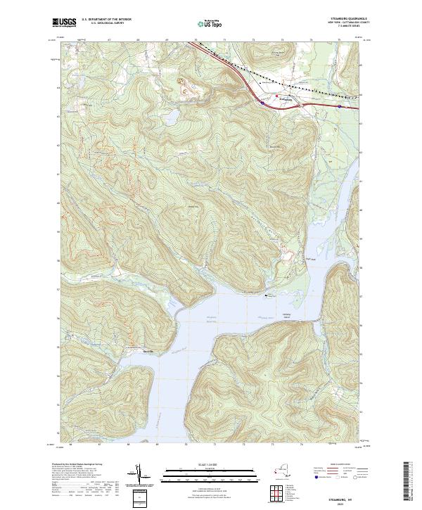
2023 Map of Steamburg
USGS Topo · Published 2023About this map
The Allegheny Reservoir dominates the landscape of this southern Cattaraugus County region, where the Allegheny River valley was transformed into a massive water body. The settlement of Steamburg remains situated at the northern edge, while the site of Onoville marks the southwestern reaches near the Pennsylvania border. This rugged terrain is characterized by numerous hollows and steep elevations such as Johnny Watt Hill, Round Top, and High Peak. Traces of the older landscape persist in the upland cemetery at Steamburg Cem and the Old Town Cem near the reservoir's eastern bank. Local history is etched into the names of the drainage network, from Sawmill Run and Hotchkiss Run to the eastern boundaries of Allegany State Park. This modern survey records the enduring topography of the Allegheny highlands, showing how the reservoir has reshaped the traditional valley settlements.
Find a feature on this map
81 named features on this map. Tap any name to fly to it.
Don’t see what you’re looking for? This feature index may not catch every label — zoom into the map to look around manually.
Map Details
Editions of this 2023 Steamburg Map
This is the sole edition of this map. No revisions or reprints were ever made.
Other maps of this area

1905 · Jamestown
USGS Topo · 1:62,500

1906 · Warren
USGS Topo · 1:62,500

1907 · Warren
USGS Topo · 1:62,500

1908 · Warren
USGS Topo · 1:62,500

1922 · Randolph
USGS Topo · 1:62,500

1923 · Randolph
USGS Topo · 1:62,500

1936 · Kinzua
USGS Topo · 1:48,000

1941 · Kinzua
USGS Topo · 1:62,500

1942 · Jamestown
USGS Topo · 1:62,500

1943 · Randolph
USGS Topo · 1:62,500