2025 Map of Steinhatchee
USGS Topo · Published 2025About this map
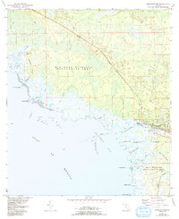
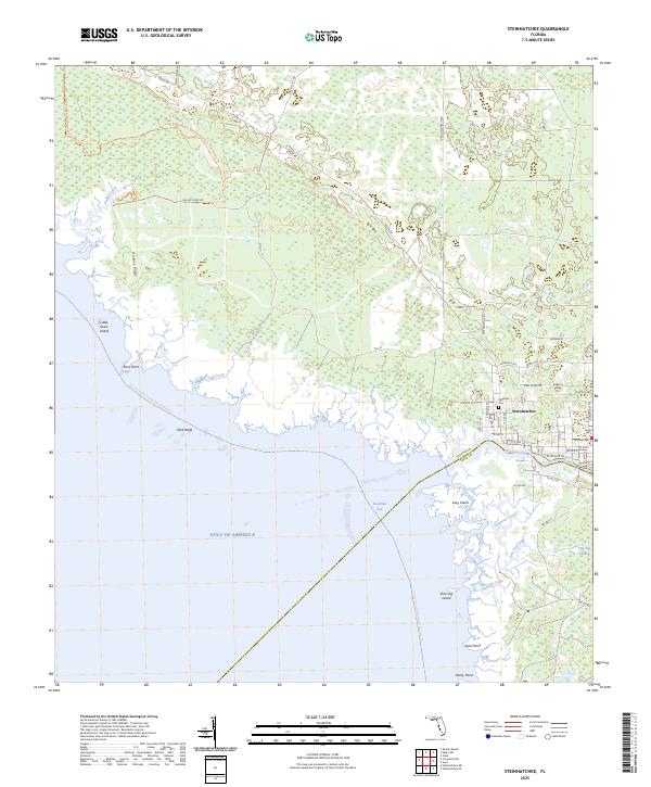
Steinhatchee sits at the junction of the Steinhatchee River and the Gulf of Mexico, serving as a coastal gateway where Taylor and Dixie counties meet. The landscape is defined by the transition from dense wetlands like Pine Log Swamp to the tidal complexity of Deadman Bay. Navigation through these waters is marked by hazards and landmarks such as Shell Reefs and Rock Point, while the interior is traversed by the Big Bend Wildlife Management Area Tide Swamp Trail. Local history is preserved at the Stephens Cemetery, situated within the residential grid of the town. The coastline is further characterized by numerous small keys and islands, including Little Grass Island and Pine Log Island, which alongside the Florida Circumnavigational Paddling Trail, reflect the region's enduring connection to the water and its reliance on the river for inland access.
Find a feature on this map
59 named features on this map. Tap any name to fly to it.
Don’t see what you’re looking for? This feature index may not catch every label — zoom into the map to look around manually.
Map Details
Editions of this 2025 Steinhatchee Map
This is the sole edition of this map. No revisions or reprints were ever made.