2022 Map of Stetsonville
USGS Topo · Published 2022About this map
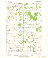
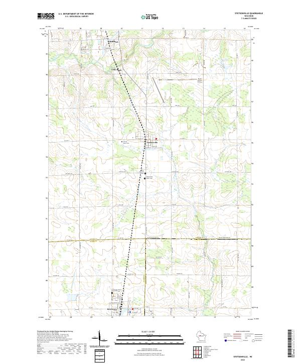
Stetsonville serves as the central hub of this Wisconsin landscape, situated along the corridor between Medford and Dorchester. The geography is defined by a dense network of local routes like Stetson Ave and Apple Ave, which connect rural farmsteads and agricultural plots. Water drainage is a prominent feature, with the Black River and Little Black River winding through the northern reaches, while the headwaters of the W Br Big Eau Pleine River and N Fork Popple River dominate the southern half. Genealogists will find significant local history preserved in the various burial grounds, including Sacred Heart Cem, Zion Lutheran Cem, and the North Dorchester Memorial Cem. To the northeast, the Taylor County Airport marks a modern point of infrastructure amidst the township sections.
Find a feature on this map
61 named features on this map. Tap any name to fly to it.
Don’t see what you’re looking for? This feature index may not catch every label — zoom into the map to look around manually.
Map Details
Editions of this 2022 Stetsonville Map
This is the sole edition of this map. No revisions or reprints were ever made.