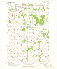
1969 Map of Stetsonville
USGS Topo · Published 1971About this map
Stetsonville sits at the heart of this Central Wisconsin landscape, where the Soo Line railroad bisects a rural patchwork of dairy country and dense woodlands. The map captures a moment in the late 1960s where the agricultural character of Taylor, Clark, and Marathon counties is clearly defined by section-line roads and numerous local institutions. Small country schools like the Victory Sch and Pleasant Valley Sch are still noted, reflecting the dispersed population of townships like Deer Creek and Little Black. To the south, the village of Dorchester borders Kalepp Lake, serving as a localized hub for the surrounding township of Mayville. The drainage patterns of the Black River and the West Branch Eau Pleine River define the local topography, while features such as the County Airport and several active Gravel Pits indicate the mid-century industrial and transportation infrastructure supporting these communities.
Find a feature on this map
34 named features on this map. Tap any name to fly to it.
Don’t see what you’re looking for? This feature index may not catch every label — zoom into the map to look around manually.
Map Details
Editions of this 1969 Stetsonville Map
This is the sole edition of this map. No revisions or reprints were ever made.
Other maps of this area

1902 · Marathon
USGS Topo · 1:125,000

1951 · Athens
USGS Topo · 1:48,000

1951 · Medford
USGS Topo · 1:48,000

1953 · Abbotsford
USGS Topo · 1:48,000

1953 · Stratford
USGS Topo · 1:48,000

1953 · Eau Claire
USGS Topo · 1:250,000

1953 · Rice Lake
USGS Topo · 1:250,000

1958 · Eau Claire
USGS Topo · 1:250,000

1959 · Rice Lake
USGS Topo · 1:250,000

1963 · Stratford
USGS Topo · 1:62,500