
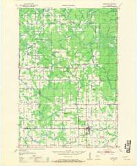
1951 Map of Athens
USGS Topo · Published 1954About this map
Athens serves as the primary hub of this 1950s landscape, situated at the confluence of the Black River and several smaller tributaries. The regional economy is anchored by the Minneapolis St Paul and Sault Ste Marie RR railroad, which links the village to Corinth and the surrounding dairy and timber lands. A dense network of rural one-room schoolhouses, such as Brueckerville Sch and Green Meadow Sch, highlights the era's decentralized educational system.
Find a feature on this map
61 named features on this map. Tap any name to fly to it.
Don’t see what you’re looking for? This feature index may not catch every label — zoom into the map to look around manually.
Map Details
Editions of this 1951 Athens Map
2 editions found
Other maps of this area

1902 · Marathon
USGS Topo · 1:125,000

1944 · Ogema
USGS Topo · 1:48,000

1945 · Rib Lake
USGS Topo · 1:48,000

1947 · Rib Lake
USGS Topo · 1:48,000

1947 · Ogema
USGS Topo · 1:48,000

1949 · Ogema
USGS Topo · 1:48,000

1949 · Rib Lake
USGS Topo · 1:48,000

1950 · Spirit Falls
USGS Topo · 1:48,000

1951 · Medford
USGS Topo · 1:48,000

1951 · Hamburg
USGS Topo · 1:48,000