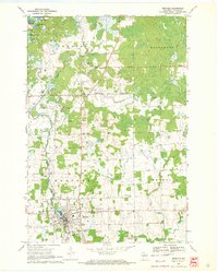
1951 Map of Medford
USGS Topo · Published 1954About this map
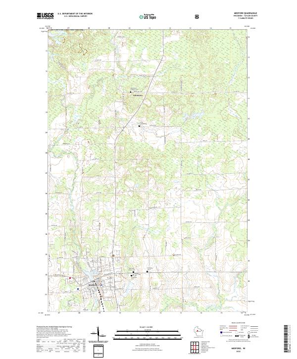
Medford serves as the central hub of this 1950s Taylor County landscape, situated where the Minneapolis St Paul and Sault Ste Marie railroad tracks bisect the region. The map reveals a dense network of rural infrastructure, characterized by an exceptionally high concentration of country schoolhouses such as Meadowbrook Sch, Thielke Sch, and Spruce Grove Sch. These institutions, alongside township halls and cemeteries like Sacred Heart Cem, highlight the organized civic life of the mid-century dairy and timber country. To the north, the glacial terrain is marked by numerous water bodies including Sackett Lake and Kathryn Lake. Evidence of earlier transport is visible in the Old Railroad Grade north of Medford, suggesting a shifting industrial footprint as local rail lines were retired or rerouted before this survey.
Find a feature on this map
80 named features on this map. Tap any name to fly to it.
Don’t see what you’re looking for? This feature index may not catch every label — zoom into the map to look around manually.
Map Details
Editions of this 1951 Medford Map
This is the sole edition of this map. No revisions or reprints were ever made.
Historical Maps of Medford Through Time
8 maps found