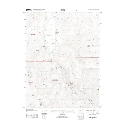
2013 Map of Suicide Mountain
USGS Topo · Published 2013About this map
White River National Forest encompasses a significant portion of this high-altitude landscape in Eagle County, defined by a complex network of agricultural and ranching infrastructure. Irrigation systems like the McBrayer and Farmer Ditch and Stratton Ditch serve the northern valley near Gypsum Creek Ranch Airport, illustrating the vital role of water management in this arid mountain environment. Further south, the terrain rises toward significant peaks including Suicide Mountain and Red Table Mountain, where public access is facilitated by historic routes such as Sundell Trail 1863. Remote landmarks like Quaker Corral and seasonal water sources like Spruce Spring point to a legacy of livestock grazing and wilderness activity. The presence of the Gypsum Creek Campground and numerous named gulches reflects the area's ongoing importance for both natural resource management and mountain recreation.
Find a feature on this map
71 named features on this map. Tap any name to fly to it.
Don’t see what you’re looking for? This feature index may not catch every label — zoom into the map to look around manually.
Map Details
Editions of this 2013 Suicide Mountain Map
This is the sole edition of this map. No revisions or reprints were ever made.
Other maps of this area

1909 · Mount Jackson
USGS Topo · 1:125,000

1911 · Mount Jackson
USGS Topo · 1:125,000

1927 · Glenwood Springs
USGS Topo · 1:125,000

1930 · Glenwood Springs
USGS Topo · 1:125,000

1957 · Leadville
USGS Topo · 1:250,000

1959 · Leadville
USGS Topo · 1:250,000

1960 · Leadville
USGS Topo · 1:250,000

1961 · Leon
USGS Topo · 1:24,000

1961 · Cottonwood Pass
USGS Topo · 1:24,000
1961 · Toner Reservoir
USGS Topo · 1:24,000