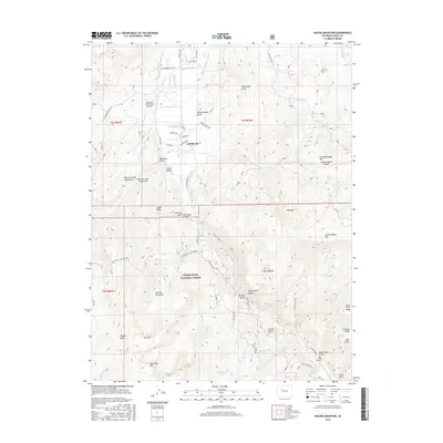
2016 Map of Suicide Mountain
USGS Topo · Published 2016About this map
Gypsum sits at the northern edge of this high-elevation landscape, where the valley floor transitions into the protected lands of the White River National Forest. The geography is defined by a complex network of water management and rugged peaks, featuring numerous irrigation structures such as the McBrayer and Fenner Ditch and Stratton Ditch that draw from Gypsum Creek. To the south, the terrain rises sharply toward Suicide Mountain and Red Table Mountain, overlooking Timber Basin. This 2016 survey illustrates the modern intersection of aviation and ranching at the Gypsum Creek Ranch Airport, alongside primitive backcountry routes like the Sundell Trail and Miller Gulch Trail. These trails and roads, including Cottonwood Pass Road, trace the drainage patterns of Hardscrabble Gulch and Tenderfoot Gulch, marking a landscape used for both high-country agriculture and wilderness access.
Find a feature on this map
75 named features on this map. Tap any name to fly to it.
Don’t see what you’re looking for? This feature index may not catch every label — zoom into the map to look around manually.
Map Details
Editions of this 2016 Suicide Mountain Map
This is the sole edition of this map. No revisions or reprints were ever made.
Other maps of this area

1909 · Mount Jackson
USGS Topo · 1:125,000

1911 · Mount Jackson
USGS Topo · 1:125,000

1927 · Glenwood Springs
USGS Topo · 1:125,000

1930 · Glenwood Springs
USGS Topo · 1:125,000

1957 · Leadville
USGS Topo · 1:250,000

1959 · Leadville
USGS Topo · 1:250,000

1960 · Leadville
USGS Topo · 1:250,000

1961 · Leon
USGS Topo · 1:24,000

1961 · Cottonwood Pass
USGS Topo · 1:24,000
1961 · Toner Reservoir
USGS Topo · 1:24,000