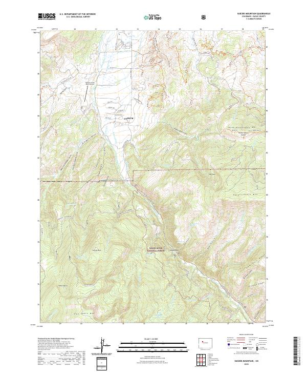
2022 Map of Suicide Mountain
USGS Topo · Published 2022About this map
The town of Gypsum serves as the primary gateway to the high-elevation terrain of the White River National Forest in this Eagle County study. The landscape is defined by the steep transition from the valley floor, where McBrayer Ditch and Stratton Ditch manage the water of Gypsum Creek, to the towering peaks of Hardscrabble Mtn and Suicide Mtn. The map documents a complex network of ranching and forest infrastructure, including the Gypsum Creek Ranch Airport and numerous forest service routes like the Gypsum Creek Road Trail. High-country features such as Dewey Park, Timber Basin, and the Fish Pond Lake reservoir illustrate the remote character of the Red Table Mountain range. This modern topographic record captures the area's intricate drainage systems, from Sundell Creek to Gerard Gulch, alongside the powerline corridors that traverse the ridges.
Find a feature on this map
122 named features on this map. Tap any name to fly to it.
Don’t see what you’re looking for? This feature index may not catch every label — zoom into the map to look around manually.
Map Details
Editions of this 2022 Suicide Mountain Map
This is the sole edition of this map. No revisions or reprints were ever made.
Other maps of this area

1909 · Mount Jackson
USGS Topo · 1:125,000

1911 · Mount Jackson
USGS Topo · 1:125,000

1927 · Glenwood Springs
USGS Topo · 1:125,000

1930 · Glenwood Springs
USGS Topo · 1:125,000

1957 · Leadville
USGS Topo · 1:250,000

1959 · Leadville
USGS Topo · 1:250,000

1960 · Leadville
USGS Topo · 1:250,000

1961 · Leon
USGS Topo · 1:24,000

1961 · Cottonwood Pass
USGS Topo · 1:24,000
1961 · Toner Reservoir
USGS Topo · 1:24,000