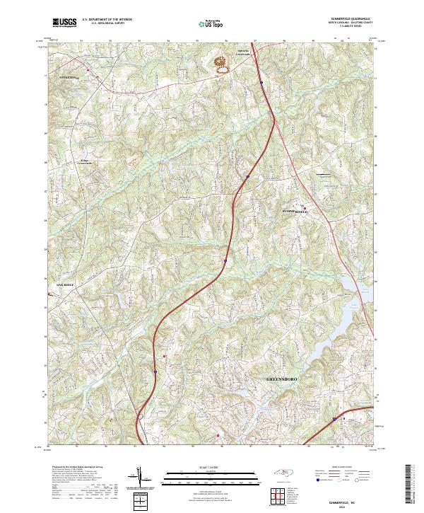
2022 Map of Summerfield
USGS Topo · Published 2022About this map
Summerfield and its surrounding Piedmont landscapes are defined by a complex network of waterways, including the upper reaches of the Haw River and the significant reservoirs of Lake Brandt and Lake Higgins. The settlement pattern at the start of the 2020s reflects a transition from rural agricultural roots to suburban expansion near the northern edge of Greensboro. Local history is anchored by sites like Bailes Old Millpond on Beaver Creek, while the intersection of historic travel routes is marked by Ogburns Crossroads and Kings Crossroads.
Find a feature on this map
111 named features on this map. Tap any name to fly to it.
Don’t see what you’re looking for? This feature index may not catch every label — zoom into the map to look around manually.
Map Details
Editions of this 2022 Summerfield Map
This is the sole edition of this map. No revisions or reprints were ever made.