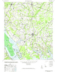
1971 Map of Summerton
USGS Topo · Published 1971About this map
Summerton serves as the central hub of this South Carolina landscape, where the agricultural plains of Clarendon County meet the expansive waters of Lake Marion. The map documents a rural society deeply connected by a network of country schools and churches, such as Wells Sch, Bacon Hill School, and St Peters Ch. To the northwest, the Poinsett State Forest transitions into the Big Bay Swamp, while the southern reaches are dominated by the swampy inlets of Cantey Bay and Potato Creek. Significant historic sites are noted, including the landmark Fort Watson near the Francis Marion Bridge. The presence of numerous artesian wells across the quadrangle suggests a reliance on specific groundwater sources for the local farms and settlements like Paxville and Davis Station during this mid-century period.
Find a feature on this map
99 named features on this map. Tap any name to fly to it.
Don’t see what you’re looking for? This feature index may not catch every label — zoom into the map to look around manually.
Map Details
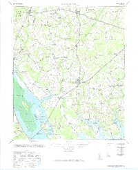
Editions of this 1971 Summerton Map
2 editions found
Other maps of this area

1920 · Eutawville
USGS Topo · 1:48,000

1920 · Chicora
USGS Topo · 1:48,000

1920 · Bowman
USGS Topo · 1:48,000

1920 · Mayesville
USGS Topo · 1:48,000

1920 · Manning
USGS Topo · 1:48,000

1921 · Chicora
USGS Topo · 1:62,500

1921 · Manning
USGS Topo · 1:62,500

1921 · Bowman
USGS Topo · 1:62,500

1921 · Mayesville
USGS Topo · 1:62,500

1921 · Eutawville
USGS Topo · 1:62,500