2023 Map of Summerville
USGS Topo · Published 2023About this map
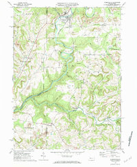
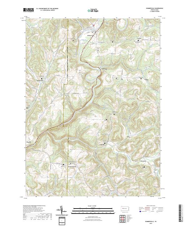
Redbank Creek winds through this rural landscape at the intersection of Jefferson, Clarion, and Armstrong counties, anchoring several small creek-side settlements. This modern survey illustrates a long-established pattern of high-ridge farming and valley-floor communities, where religious life remains central as evidenced by numerous historic grounds like the Bethlehem Lutheran Cem and North Freedom United Methodist Church Cem. The terrain is deeply incised by waters such as Little Sandy Creek and Beaver Run, which have shaped the local road network and the placement of villages like Summerville and Worthville. Genealogists will find particular value in the meticulous documentation of family-named burial sites including Vandervort Cem and Carrier Cem, which are scattered throughout the hills near Heathville and Pansy.
Find a feature on this map
84 named features on this map. Tap any name to fly to it.
Don’t see what you’re looking for? This feature index may not catch every label — zoom into the map to look around manually.
Map Details
Editions of this 2023 Summerville Map
This is the sole edition of this map. No revisions or reprints were ever made.