2024 Map of Sunflower
USGS Topo · Published 2024About this map
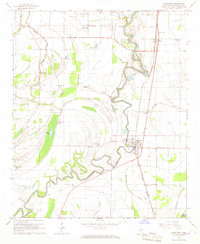
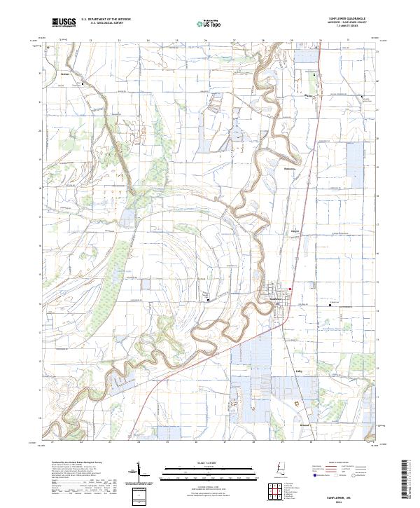
The Big Sunflower River meanders in tight oxbows through this section of the Mississippi Delta, defining a landscape traditionally dominated by agriculture and waterway transport. The town of Sunflower serves as the central hub of this survey, surrounded by smaller communities and rural crossroads such as Blaine, Pentecost, and Inwood. For genealogists and local historians, the map provides precise locations for several regional burial sites including Saint James Cem, New Hope Cem, and Willing Worker Cem. The intricate network of local roads, such as Steed Mixon Rd and Bobby Kirk Rd, connects these settlements across the low-lying terrain. To the south, the distinctive Turkeyfoot Brake and the winding course of Bear Bayou illustrate the persistent wetland characteristics of the region, while Box Field and numerous bayous like Jones Bayou show how the land has been managed for local use.
Find a feature on this map
71 named features on this map. Tap any name to fly to it.
Don’t see what you’re looking for? This feature index may not catch every label — zoom into the map to look around manually.
Map Details
Editions of this 2024 Sunflower Map
This is the sole edition of this map. No revisions or reprints were ever made.