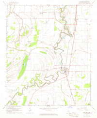
1966 Map of Sunflower
USGS Topo · Published 1967About this map
Big Sunflower River winds through the heart of this Delta landscape, defining a region where the water's path and the rail lines dictated the placement of towns and churches. In the mid-1960s, the town of Sunflower served as a central hub along the Illinois Central railroad, surrounded by a dense network of country churches like King Solomon Ch, McKinney Chapel, and Duncan Chapel. The landscape is a complex system of oxbow lakes and wetlands, including Binson Lake, Gorman Lake, and Shackelford Lake, reflecting the ancient movements of the river.
Find a feature on this map
34 named features on this map. Tap any name to fly to it.
Don’t see what you’re looking for? This feature index may not catch every label — zoom into the map to look around manually.
Map Details
Editions of this 1966 Sunflower Map
This is the sole edition of this map. No revisions or reprints were ever made.
Other maps of this area

1931 · Schlater
USGS Topo · 1:48,000

1934 · Cleveland
USGS Topo · 1:62,500

1934 · Schlater
USGS Topo · 1:62,500

1939 · Schlater
USGS Topo · 1:62,500

1940 · Baird
USGS Topo · 1:62,500

1940 · Cleveland
USGS Topo · 1:62,500

1953 · Greenwood
USGS Topo · 1:250,000

1956 · Greenwood
USGS Topo · 1:250,000

1961 · Mossy Lake
USGS Topo · 1:62,500
1961 · Schlater
USGS Topo · 1:62,500