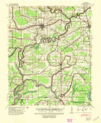
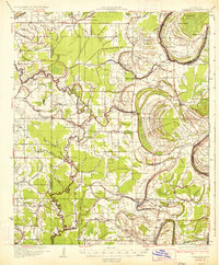
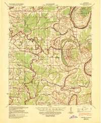
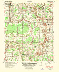
1940 Map of Baird
USGS Topo · Published 1942About this map
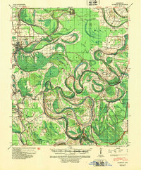
Sunflower County's complex drainage network defines this 1940 landscape, where the meandering Sunflower River and its numerous bayous are managed by an extensive system of man-made channels such as Ditch No 25 and Ditch No 12. The region's agricultural and transit roots are evident in the concentration of small rail-stop communities like Johnsonville and Baird, supported by the Columbus and Greenville and Illinois Central railroads.
Find a feature on this map
98 named features on this map. Tap any name to fly to it.
Don’t see what you’re looking for? This feature index may not catch every label — zoom into the map to look around manually.
Map Details
Editions of this 1940 Baird Map
This is the sole edition of this map. No revisions or reprints were ever made.
Other maps of this area

1931 · Schlater
USGS Topo · 1:48,000

1934 · Cleveland
USGS Topo · 1:62,500
1934 · Schlater
USGS Topo · 1:62,500
1939 · Schlater
USGS Topo · 1:62,500

1939 · Tralake
USGS Topo · 1:62,500

1939 · Choctaw
USGS Topo · 1:62,500

1939 · Swan Lake
USGS Topo · 1:62,500

1940 · Auter
USGS Topo · 1:62,500
1940 · Cleveland
USGS Topo · 1:62,500
1940 · Mileston
USGS Topo · 1:62,500