
1939 Map of Choctaw
USGS Topo · Published 1965About this map
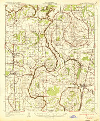
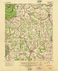
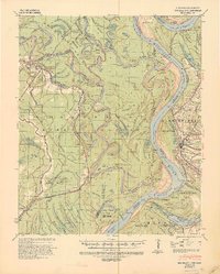
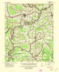
Bogue Phalia and its winding tributaries dominate this landscape in the heart of the Mississippi Delta, as recorded by the War Department Corps of Engineers during the late 1930s. The region is defined by an extensive drainage network, including the Yazoo Canal and Hasty Canal, supporting a sprawling agricultural economy. Key settlements such as Shaw and Lobdell are connected by the Illinois Central Railroad, while smaller communities like Grapeland, Dahomy, and Choctaw reflect the local social fabric centered around rural institutions.
Find a feature on this map
49 named features on this map. Tap any name to fly to it.
Don’t see what you’re looking for? This feature index may not catch every label — zoom into the map to look around manually.
Map Details
Editions of this 1939 Choctaw Map
This is the sole edition of this map. No revisions or reprints were ever made.
Other maps of this area

1931 · Drew
USGS Topo · 1:48,000

1933 · Lamont
USGS Topo · 1:62,500

1934 · Cleveland
USGS Topo · 1:62,500
1935 · Mound Bayou
USGS Topo · 1:62,500
1939 · Pace
USGS Topo · 1:62,500
1939 · Big Island
USGS Topo · 1:62,500

1939 · Refuge
USGS Topo · 1:62,500

1939 · Lamont
USGS Topo · 1:62,500

1939 · Tralake
USGS Topo · 1:62,500
1940 · Baird
USGS Topo · 1:62,500