
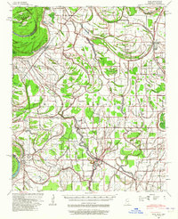
1939 Map of Pace
USGS Topo · Published 1942About this map
The Yazoo and Mississippi Valley RR anchors the eastern half of this Delta landscape, connecting the agricultural hubs of Shelby and Gunnison. The terrain is defined by its complex hydrology, where the Mississippi River forms a shifting western boundary around Island No 71 and Concordia Island. A sophisticated network of man-made ditches, such as Little Ditch No 1, works alongside natural waterways like Bogue Phalia and Snake Creek to manage the fertile but swampy bottomlands.
Find a feature on this map
54 named features on this map. Tap any name to fly to it.
Don’t see what you’re looking for? This feature index may not catch every label — zoom into the map to look around manually.
Map Details
Editions of this 1939 Pace Map
2 editions found
Other maps of this area

1930 · Mellwood
USGS Topo · 1:62,500

1931 · Drew
USGS Topo · 1:48,000

1933 · Lamont
USGS Topo · 1:62,500

1934 · Cleveland
USGS Topo · 1:62,500

1935 · Clarksdale
USGS Topo · 1:62,500

1935 · Mound Bayou
USGS Topo · 1:62,500

1939 · Henrico
USGS Topo · 1:62,500

1939 · Clarksdale
USGS Topo · 1:62,500

1939 · Big Island
USGS Topo · 1:62,500

1939 · Mellwood
USGS Topo · 1:62,500