
1930 Map of Mellwood
USGS Topo · Published 1930About this map
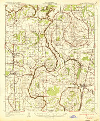
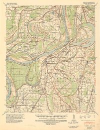
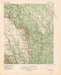
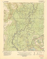
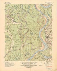
The Mississippi River creates a complex landscape of oxbows and shifting banks along the border of Arkansas and Mississippi in this 1930 survey. The map documents the persistent struggle against the river's power, marking the locations of the Ferguson Crevasse 1912 and the Knowlton Crevasse 1913, where the levee system failed during early 20th-century floods. Extensive engineering efforts are visible through the Sunflower Revetment and Knowlton Revetment, which attempt to stabilize the channel near Knowlton and Sunflower Bend.
Find a feature on this map
71 named features on this map. Tap any name to fly to it.
Don’t see what you’re looking for? This feature index may not catch every label — zoom into the map to look around manually.
Map Details
Editions of this 1930 Mellwood Map
This is the sole edition of this map. No revisions or reprints were ever made.
Other maps of this area

1931 · Drew
USGS Topo · 1:48,000

1935 · Clarksdale
USGS Topo · 1:62,500
1935 · Mound Bayou
USGS Topo · 1:62,500
1939 · Farrell
USGS Topo · 1:62,500

1939 · Modoc
USGS Topo · 1:62,500
1939 · Indian Bay
USGS Topo · 1:62,500
1939 · Henrico
USGS Topo · 1:62,500
1939 · Pace
USGS Topo · 1:62,500

1939 · Clarksdale
USGS Topo · 1:62,500
1939 · Big Island
USGS Topo · 1:62,500