
1939 Map of Modoc
USGS Topo · Published 1941About this map
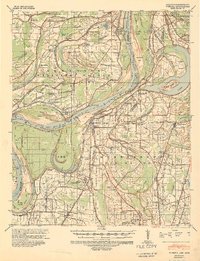
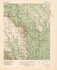
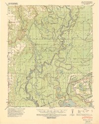
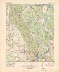
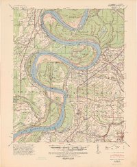
The Mississippi River dominates this 1939 survey, its course marked by historical meander lines from 1833 and 1835 that reveal the shifting boundary between Arkansas and Mississippi. Along the river’s western banks in Phillips County, a dense network of plantation-era infrastructure is visible, including the Missouri Pacific railroad line and numerous tramways serving timber or agricultural interests. The landscape is a complex system of sloughs and bayous, such as Humphrey Slough and McGehee Bayou, indicating a terrain heavily influenced by seasonal flooding and river migration.
Find a feature on this map
97 named features on this map. Tap any name to fly to it.
Don’t see what you’re looking for? This feature index may not catch every label — zoom into the map to look around manually.
Map Details
Editions of this 1939 Modoc Map
This is the sole edition of this map. No revisions or reprints were ever made.
Other maps of this area

1930 · Mellwood
USGS Topo · 1:62,500

1935 · Clarksdale
USGS Topo · 1:62,500
1939 · Farrell
USGS Topo · 1:62,500
1939 · Indian Bay
USGS Topo · 1:62,500
1939 · Henrico
USGS Topo · 1:62,500

1939 · Clarksdale
USGS Topo · 1:62,500
1939 · Latour
USGS Topo · 1:62,500
1939 · Mellwood
USGS Topo · 1:62,500
1940 · Marvell
USGS Topo · 1:62,500
1940 · Holly Grove
USGS Topo · 1:62,500