
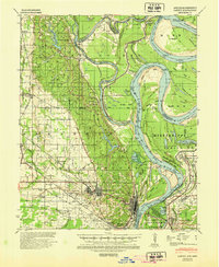
1939 Map of Latour
USGS Topo · Published 1944About this map
The confluence of the St. Francis River and the Mississippi River dominates this landscape on the eve of the 1940s, highlighting the intricate hydrological and social patterns of the Delta. This period shows Helena and West Helena as established urban centers connected by the Missouri Pacific railroad, while the surrounding rural landscape is dotted with small settlements like Southland and Latour.
Find a feature on this map
74 named features on this map. Tap any name to fly to it.
Don’t see what you’re looking for? This feature index may not catch every label — zoom into the map to look around manually.
Map Details
Editions of this 1939 Latour Map
2 editions found
Other maps of this area

1908 · Lula
USGS Topo · 1:24,000

1908 · Dundee
USGS Topo · 1:24,000

1908 · Moon Lake
USGS Topo · 1:24,000

1910 · Dundee
USGS Topo · 1:31,680

1912 · Moon Lake
USGS Topo · 1:31,680

1912 · Lula
USGS Topo · 1:31,680

1931 · Horseshoe Lake
USGS Topo · 1:62,500

1932 · Marks
USGS Topo · 1:48,000

1935 · Marks
USGS Topo · 1:62,500

1939 · Clayton
USGS Topo · 1:62,500