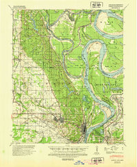
1939 Map of Latour
USGS Topo · Published 1945About this map
Helena and West Helena serve as the focal points of this mid-century survey, illustrating a landscape defined by the convergence of the Mississippi River and the St Francis River. The map meticulously records the intricate river hydraulics and the agricultural hinterlands of Phillips County, Arkansas, and Tunica County, Mississippi. The settlement pattern follows the Missouri Pacific railroad line, linking communities like Lexa, Latour, and Southland.
Find a feature on this map
83 named features on this map. Tap any name to fly to it.
Don’t see what you’re looking for? This feature index may not catch every label — zoom into the map to look around manually.
Map Details
Editions of this 1939 Latour Map
2 editions found

Other maps of this area

1908 · Lula
USGS Topo · 1:24,000

1908 · Dundee
USGS Topo · 1:24,000

1908 · Moon Lake
USGS Topo · 1:24,000

1910 · Dundee
USGS Topo · 1:31,680

1912 · Moon Lake
USGS Topo · 1:31,680

1912 · Lula
USGS Topo · 1:31,680

1931 · Horseshoe Lake
USGS Topo · 1:62,500

1932 · Marks
USGS Topo · 1:48,000

1935 · Marks
USGS Topo · 1:62,500

1939 · Clayton
USGS Topo · 1:62,500