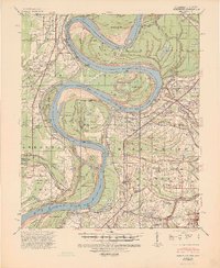
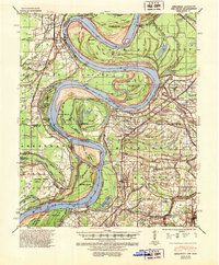
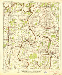
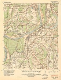
1939 Map of Mellwood
USGS Topo · Published 1946About this map
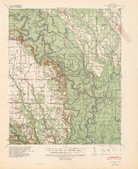
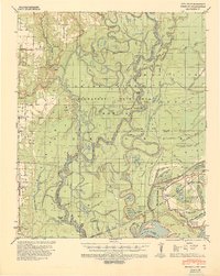
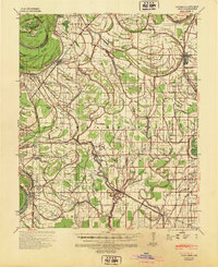
Laconia Circle anchors the Arkansas side of this Mississippi River survey, representing a unique 19th-century levee system designed to protect cotton lands from the river's unpredictable meanders. The landscape is defined by the massive bends of the Mississippi River, creating a series of substantial river features including Island No. 64 and Island No. 66. Along the western bank, the Missouri Pacific railroad serves a string of agricultural landings and small settlements like Mellwood and Ferguson.
Find a feature on this map
77 named features on this map. Tap any name to fly to it.
Don’t see what you’re looking for? This feature index may not catch every label — zoom into the map to look around manually.
Map Details
Editions of this 1939 Mellwood Map
2 editions found
Other maps of this area

1930 · Mellwood
USGS Topo · 1:62,500

1931 · Drew
USGS Topo · 1:48,000

1935 · Clarksdale
USGS Topo · 1:62,500
1935 · Mound Bayou
USGS Topo · 1:62,500
1939 · Farrell
USGS Topo · 1:62,500

1939 · Modoc
USGS Topo · 1:62,500
1939 · Indian Bay
USGS Topo · 1:62,500
1939 · Henrico
USGS Topo · 1:62,500
1939 · Pace
USGS Topo · 1:62,500

1939 · Clarksdale
USGS Topo · 1:62,500