
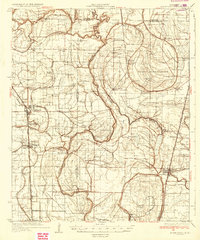
1935 Map of Mound Bayou
USGS Topo · Published 1935About this map
Mound Bayou stands as a focal point of this Delta landscape, situated along the Yazoo and Mississippi Valley Railroad in a region defined by its dense network of bayous and alluvial plains. The map reveals an intricate social geography of the 1930s, marked by numerous rural churches and schools like Strangers Home Ch and White Zion Sch that served the farming communities between the Sunflower River and the Hushpuckena River.
Find a feature on this map
75 named features on this map. Tap any name to fly to it.
Don’t see what you’re looking for? This feature index may not catch every label — zoom into the map to look around manually.
Map Details
Editions of this 1935 Mound Bayou Map
2 editions found
Other maps of this area

1930 · Mellwood
USGS Topo · 1:62,500

1931 · Schlater
USGS Topo · 1:48,000

1931 · Sumner
USGS Topo · 1:48,000

1931 · Drew
USGS Topo · 1:48,000

1932 · Tutwiler
USGS Topo · 1:48,000

1934 · Cleveland
USGS Topo · 1:62,500

1934 · Schlater
USGS Topo · 1:62,500

1935 · Clarksdale
USGS Topo · 1:62,500

1935 · Sumner
USGS Topo · 1:62,500

1935 · Tutwiler
USGS Topo · 1:62,500