
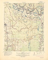
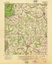
1933 Map of Lamont
USGS Topo · Published 1933About this map
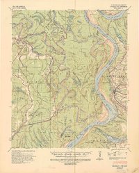
Arkansas City sits at a critical bend in the Mississippi River, serving as a focal point for this 1930s-era riverine landscape. The map meticulously documents the ever-shifting nature of the waterway, contrasting historical meander lines from the 1820s and 1830s against the modern channel. This tension between the river and the land is underscored by the presence of the Mound Crevasse (1927), a stark reminder of the Great Flood that had recently reshaped the region's geography and infrastructure.
Find a feature on this map
80 named features on this map. Tap any name to fly to it.
Don’t see what you’re looking for? This feature index may not catch every label — zoom into the map to look around manually.
Map Details
Editions of this 1933 Lamont Map
This is the sole edition of this map. No revisions or reprints were ever made.
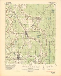
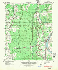
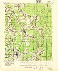
Other maps of this area
1935 · Red Fork
USGS Topo · 1:62,500
1936 · McGehee
USGS Topo · 1:62,500
1936 · Lake Village
USGS Topo · 1:62,500
1937 · McGehee
USGS Topo · 1:62,500
1939 · Pace
USGS Topo · 1:62,500
1939 · Big Island
USGS Topo · 1:62,500

1939 · Refuge
USGS Topo · 1:62,500

1939 · Lamont
USGS Topo · 1:62,500

1939 · Tralake
USGS Topo · 1:62,500

1939 · Choctaw
USGS Topo · 1:62,500