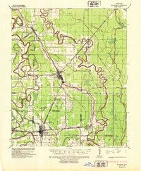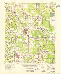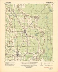
1936 Map of McGehee
USGS Topo · Published 1937About this map
The Missouri Pacific rail lines anchor the agricultural and commercial activity of the Arkansas Delta in this mid-1930s survey. The town of Mcgehee emerges as a significant regional hub at the junction of the Missouri Pacific M H & L Division and multiple state highways. To the south, Dermott shows a dense street grid where the railroad meets Bayou Bartholomew. The landscape is defined by the winding paths of Bayou Macon and Crooked Bayou, which snake across the county lines of Desha, Drew, and Chicot.
Find a feature on this map
35 named features on this map. Tap any name to fly to it.
Don’t see what you’re looking for? This feature index may not catch every label — zoom into the map to look around manually.
Map Details
Editions of this 1936 McGehee Map
This is the sole edition of this map. No revisions or reprints were ever made.