
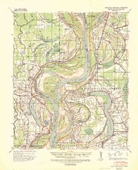
1939 Map of Tralake
USGS Topo · Published 1964About this map
The sinuous path of Deer Creek dominates this Delta landscape, winding through a network of early 20th-century agricultural settlements and drainage infrastructure. This area, surveyed during the 1930s, reveals a highly managed environment where natural waterways like Bogue Phalia and Black Bayou are augmented by an extensive system of numbered ditches, including the Shell Lake Cut-Off. The map documents the vital State Agricultural Exp Station near Stoneville, reflecting the region's deep commitment to scientific farming.
Find a feature on this map
104 named features on this map. Tap any name to fly to it.
Don’t see what you’re looking for? This feature index may not catch every label — zoom into the map to look around manually.
Map Details
Editions of this 1939 Tralake Map
This is the sole edition of this map. No revisions or reprints were ever made.
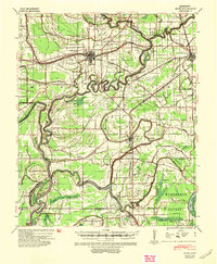
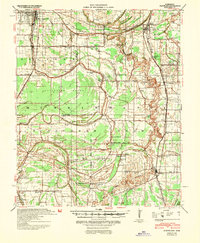
Other maps of this area

1933 · Lamont
USGS Topo · 1:62,500

1934 · Cleveland
USGS Topo · 1:62,500
1939 · Readland
USGS Topo · 1:62,500

1939 · Refuge
USGS Topo · 1:62,500

1939 · Lamont
USGS Topo · 1:62,500

1939 · Choctaw
USGS Topo · 1:62,500

1939 · Swan Lake
USGS Topo · 1:62,500

1940 · Auter
USGS Topo · 1:62,500
1940 · Baird
USGS Topo · 1:62,500
1940 · Cleveland
USGS Topo · 1:62,500