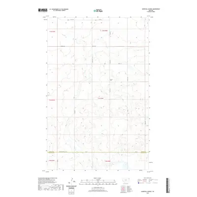
2020 Map of Sunnyhill School
USGS Topo · Published 2020About this map
Sunnyhill School serves as a central landmark in this high plains landscape of northeastern Montana along the Sheridan Co Roosevelt Co border. The terrain is defined by the winding course of Sand Cr, which creates a network of drainage patterns across the prairie. This area remains largely defined by its rural grid, where the intersection of Sunnyhill Rd and Viewhill Rd provides access to the scattered farmsteads and agricultural plots typical of this region near the Canadian border. The map illustrates a modern snapshot of the enduring road network, including thoroughfares like E Lake Hwy and Sandhills Rd, which link the isolated educational and community hubs to the wider county. The section lines of the Public Land Survey System remain the primary organizing principle for movement and ownership in this open country.
Find a feature on this map
17 named features on this map. Tap any name to fly to it.
Don’t see what you’re looking for? This feature index may not catch every label — zoom into the map to look around manually.
Map Details
Editions of this 2020 Sunnyhill School Map
This is the sole edition of this map. No revisions or reprints were ever made.
Other maps of this area

1946 · Brush Lake
USGS Topo · 1:24,000

1946 · Dagmar
USGS Topo · 1:24,000

1947 · Capeneys Lake
USGS Topo · 1:24,000

1948 · Capeneys Lake
USGS Topo · 1:24,000

1948 · Dagmar
USGS Topo · 1:24,000

1948 · Brush Lake
USGS Topo · 1:24,000

1948 · Reserve SE
USGS Topo · 1:24,000

1948 · Sunnyhill School
USGS Topo · 1:24,000

1949 · Reserve SE
USGS Topo · 1:24,000

1949 · Sunnyhill School
USGS Topo · 1:24,000