2023 Map of Sunnyside
USGS Topo · Published 2023About this map
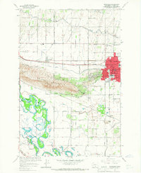
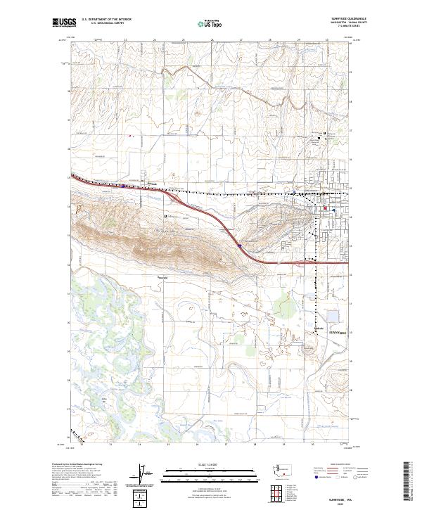
The Yakima Valley's intricate irrigation network is the defining characteristic of this landscape, with the Sunnyside Canal and Outlook Canal cutting across the northern elevations. Between the slopes of Snipes Mtn and the Yakima River, the territory is organized into a tight grid of agricultural fields and water management features like the Granger Drain and Turner Lateral. This 2023 survey documents the modern layout of Sunnyside, noting several significant local history landmarks including the Old Sunnyside Cem and Lower Valley Memorial Gardens. To the southwest, the Toppenish National Wildlife Refuge preserves the riparian wetlands near Satus Bar, contrasting with the managed agricultural plains near Emerald and Midvale. The prominence of local topographic markers like Harrison Hill and the uniquely named Peanut Hump provide clear orientation points for researchers examining the contemporary development of Yakima County.
Find a feature on this map
120 named features on this map. Tap any name to fly to it.
Don’t see what you’re looking for? This feature index may not catch every label — zoom into the map to look around manually.
Map Details
Editions of this 2023 Sunnyside Map
This is the sole edition of this map. No revisions or reprints were ever made.