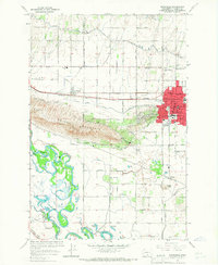
1965 Map of Sunnyside
USGS Topo · Published 1967About this map
Snipes Mountain dominates the central landscape of this Yakima County region, providing a high-ground backdrop to the burgeoning agricultural infrastructure of the mid-1960s. The city of Sunnyside is the clear population center, characterized by its grid of schools like Chief Kamiakin Sch and Lincoln Sch, along with the Northern Pacific railroad corridor. The complexity of the local irrigation system is evident through the winding path of the Sunnyside Canal and numerous siphons and pumping stations that distribute water across the valley.
Find a feature on this map
65 named features on this map. Tap any name to fly to it.
Don’t see what you’re looking for? This feature index may not catch every label — zoom into the map to look around manually.
Map Details
Editions of this 1965 Sunnyside Map
This is the sole edition of this map. No revisions or reprints were ever made.
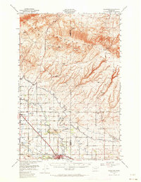
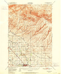
Other maps of this area

1910 · Zillah
USGS Topo · 1:125,000

1915 · Prosser
USGS Topo · 1:125,000

1917 · Prosser
USGS Topo · 1:125,000

1950 · Yakima
USGS Topo · 1:250,000
1950 · Grandview
USGS Topo · 1:62,500
1951 · Grandview
USGS Topo · 1:62,500

1953 · Walla Walla
USGS Topo · 1:250,000

1958 · Walla Walla
USGS Topo · 1:250,000

1958 · Yakima
USGS Topo · 1:250,000

1961 · Yakima
USGS Topo · 1:250,000