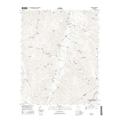
2016 Map of Sunrise
USGS Topo · Published 2016About this map
Big Swan Creek and its many winding tributaries define the landscape of this southern Hickman County survey, where the Hickman Co and Lewis Co line meets the southern boundary. Small settlements like Sunrise and Swan Bluff are situated along the valley floors, surrounded by an intricate network of hollows named for early families, including Tatum Hollow, Burns Hollow, and Pettas Hollow. The map reveals a deeply etched topography of ridges and drainages, such as Little Piney Cr and Ugly Cr, that dictated the placement of early homesteads and cemeteries. The southern portion of the sheet is bisected by the Natchez Trace Parkway and National Scenic Trail, following the ancient travel corridor through the Tennessee hills. Numerous family burial grounds, including Whiteside Cem and Campground Cem, are tucked away near these drainages, offering valuable data for genealogical research into the area's rural history.
Find a feature on this map
110 named features on this map. Tap any name to fly to it.
Don’t see what you’re looking for? This feature index may not catch every label — zoom into the map to look around manually.
Map Details
Editions of this 2016 Sunrise Map
This is the sole edition of this map. No revisions or reprints were ever made.
Other maps of this area

1901 · Colombia
USGS Topo · 1:125,000

1936 · Mt Joy
USGS Topo · 1:24,000

1936 · Beaverdam Springs
USGS Topo · 1:24,000

1936 · Nunnelly
USGS Topo · 1:24,000

1936 · Whitfield
USGS Topo · 1:24,000

1936 · Sunrise
USGS Topo · 1:24,000

1936 · Littlelot
USGS Topo · 1:24,000

1936 · Greenfield Bend
USGS Topo · 1:24,000

1936 · Kimmins
USGS Topo · 1:24,000

1936 · Gordonsburg
USGS Topo · 1:24,000