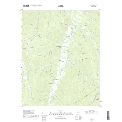
2019 Map of Sunrise
USGS Topo · Published 2019About this map
Big Swan Creek winds through this section of Middle Tennessee, defining a landscape of narrow hollows and high ridges at the border of Hickman and Lewis Counties. The valley floor supports small settlements such as Sunrise and Swan Bluff, while the surrounding terrain is etched with dozens of named geographic features like Stillhouse Hollow and Sugarcamp Hollow that hint at the local subsistence history of the region.
Find a feature on this map
110 named features on this map. Tap any name to fly to it.
Don’t see what you’re looking for? This feature index may not catch every label — zoom into the map to look around manually.
Map Details
Editions of this 2019 Sunrise Map
This is the sole edition of this map. No revisions or reprints were ever made.
Other maps of this area

1901 · Colombia
USGS Topo · 1:125,000

1936 · Mt Joy
USGS Topo · 1:24,000

1936 · Beaverdam Springs
USGS Topo · 1:24,000

1936 · Nunnelly
USGS Topo · 1:24,000

1936 · Whitfield
USGS Topo · 1:24,000

1936 · Sunrise
USGS Topo · 1:24,000

1936 · Littlelot
USGS Topo · 1:24,000

1936 · Greenfield Bend
USGS Topo · 1:24,000

1936 · Kimmins
USGS Topo · 1:24,000

1936 · Gordonsburg
USGS Topo · 1:24,000