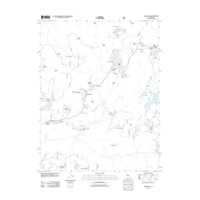
2012 Map of Tamarack
USGS Topo · Published 2012About this map
Bear Valley serves as a central hub for recreation and residential life in this portion of the Sierra Nevada. The terrain is characterized by a complex network of seasonal camps and recreational facilities, including Camp Wolfeboro and Del Orto Camp, alongside organized communities such as Sherman Acres, Lombardi, and Tamarack. The landscape is dominated by significant water features, with the N Fork Stanislaus River and Highland Cr carving through the valleys, while the Utica Reservoir and Spicer Meadow Reservoir provide major water storage at the eastern edge.
Find a feature on this map
113 named features on this map. Tap any name to fly to it.
Don’t see what you’re looking for? This feature index may not catch every label — zoom into the map to look around manually.
Map Details
Editions of this 2012 Tamarack Map
This is the sole edition of this map. No revisions or reprints were ever made.
Other maps of this area

1889 · Pyramid Peak
USGS Topo · 1:125,000

1889 · Markleeville
USGS Topo · 1:125,000

1891 · Markleeville
USGS Topo · 1:125,000

1891 · Big Trees
USGS Topo · 1:125,000

1891 · Pyramid Peak
USGS Topo · 1:125,000

1893 · Markleeville
USGS Topo · 1:125,000

1894 · Big Trees
USGS Topo · 1:125,000

1895 · Pyramid Peak
USGS Topo · 1:125,000

1896 · Dardanelles
USGS Topo · 1:125,000

1896 · Pyramid Peak
USGS Topo · 1:125,000