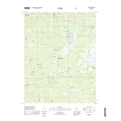
2018 Map of Tamarack
USGS Topo · Published 2018About this map
Bear Valley serves as a primary hub for activity within the high-elevation terrain of the Stanislaus National Forest in this 2018 survey. The landscape is defined by the headwaters and drainage of the N Fork Stanislaus River and Highland Cr, surrounded by a series of named alpine meadows such as Bloods Meadow, Big Meadow, and Mattley Meadow. This region, historically significant for trans-Sierra travel, shows the enduring path of the Emigrant Trail cutting through the northeast corner near Osborn Hill. The proximity of Lake Alpine and the Bear Valley Airport indicates the modern recreational development of the area, yet the map also preserves local historical names like Hells Kitchen and Bloods Ridge. Topography is detailed through complex contouring, highlighting landmarks like Slick Rock and Flagpole Point among the diverse forest service routes and winter recreation trails.
Find a feature on this map
74 named features on this map. Tap any name to fly to it.
Don’t see what you’re looking for? This feature index may not catch every label — zoom into the map to look around manually.
Map Details
Editions of this 2018 Tamarack Map
This is the sole edition of this map. No revisions or reprints were ever made.
Other maps of this area

1889 · Pyramid Peak
USGS Topo · 1:125,000

1889 · Markleeville
USGS Topo · 1:125,000

1891 · Markleeville
USGS Topo · 1:125,000

1891 · Big Trees
USGS Topo · 1:125,000

1891 · Pyramid Peak
USGS Topo · 1:125,000

1893 · Markleeville
USGS Topo · 1:125,000

1894 · Big Trees
USGS Topo · 1:125,000

1895 · Pyramid Peak
USGS Topo · 1:125,000

1896 · Dardanelles
USGS Topo · 1:125,000

1896 · Pyramid Peak
USGS Topo · 1:125,000