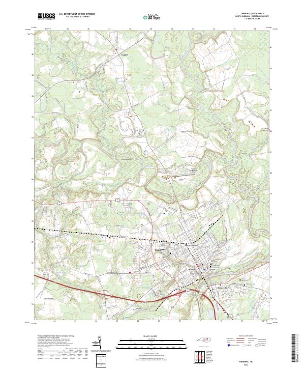
2022 Map of Tarboro
USGS Topo · Published 2022About this map
The Tar River serves as the central geographic feature of this 2022 survey, winding past the historic town of Tarboro and its neighbor Princeville. The layout of these communities reveals their deep relationship with the waterway, particularly where the Tarboro Canal and Hendricks Cr intersect the urban grid. The map highlights several culturally significant sites, including the Calvary Episcopal Churchyard and the Old Town Cem, alongside modern developments like the Edgecombe Community College campus and the Tarboro-Edgecombe Airport.
Find a feature on this map
142 named features on this map. Tap any name to fly to it.
Don’t see what you’re looking for? This feature index may not catch every label — zoom into the map to look around manually.
Map Details
Editions of this 2022 Tarboro Map
This is the sole edition of this map. No revisions or reprints were ever made.
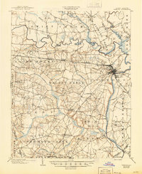
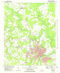
Historical Maps of Tarboro Through Time
4 maps found