2022 Map of Taylorsville
USGS Topo · Published 2022About this map
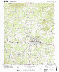
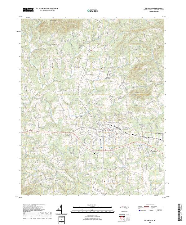
Taylorsville serves as the central hub of this Alexander County landscape, anchored by the Alexander County Courthouse and a surrounding network of local industry and aviation. The town's layout transitions from its structured core to the winding rural routes that follow the complex hydrology of the Lower Little River and its numerous tributaries like Muddy Fork and Grassy Cr. The geography is defined by prominent peaks including Linney Mtn and Coon Mtn, which overlook a mix of small-scale agriculture and private residential developments.
Find a feature on this map
193 named features on this map. Tap any name to fly to it.
Don’t see what you’re looking for? This feature index may not catch every label — zoom into the map to look around manually.
Map Details
Editions of this 2022 Taylorsville Map
This is the sole edition of this map. No revisions or reprints were ever made.