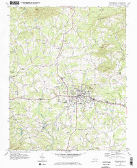
1970 Map of Taylorsville
USGS Topo · Published 1973About this map
Taylorsville serves as the focal point of this 1970s topographic survey, showing a landscape defined by the winding Lower Little River and the Alexander railroad line. The map captures the town's social and institutional infrastructure, from the Alexander Central High School and Hospital to more specialized sites like the State Correctional Unit and the County Fairgrounds. Cultural and recreational life is evident in the mid-century presence of the Drive-in Theater along the highway and a Golf Course near the river.
Find a feature on this map
53 named features on this map. Tap any name to fly to it.
Don’t see what you’re looking for? This feature index may not catch every label — zoom into the map to look around manually.
Map Details
Editions of this 1970 Taylorsville Map
This is the sole edition of this map. No revisions or reprints were ever made.
Other maps of this area

1889 · Wilkesboro
USGS Topo · 1:125,000

1891 · Wilkesboro
USGS Topo · 1:125,000

1895 · Hickory
USGS Topo · 1:125,000

1953 · Charlotte
USGS Topo · 1:250,000

1953 · Winston-Salem
USGS Topo · 1:250,000

1954 · Charlotte
USGS Topo · 1:250,000

1955 · Winston-Salem
USGS Topo · 1:250,000

1960 · Charlotte
USGS Topo · 1:250,000

1962 · Winston-Salem
USGS Topo · 1:250,000

1962 · Charlotte
USGS Topo · 1:250,000