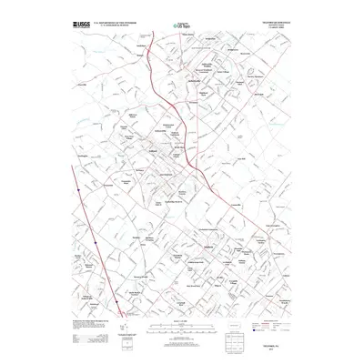
2013 Map of Telford
USGS Topo · Published 2013About this map
Souderton and Telford form the densely settled core of this Montgomery County landscape, where residential developments like Bridle Run and Telford Hills interweave with a legacy of crossroads communities. The map highlights a transition from suburban corridors to more open terrain near Almont and Naceville, defined by a network of waterways including the Skippack Creek and Ridge Valley Creek. Cultural and historic markers are prominent, from the South Perkasie Covered Bridge in the north to the Village at Salford Mill further south. Local industry and aviation are noted through several small airfields like Gunden Airport and Gehris Airport, while the Pennsylvania Turnpike Interchange 31 marks a modern transportation artery through the township of Franconia. This record captures the precise settlement pattern and suburban expansion within the Perkiomen and Neshaminy watersheds at the start of the 2010s.
Find a feature on this map
432 named features on this map. Tap any name to fly to it.
Don’t see what you’re looking for? This feature index may not catch every label — zoom into the map to look around manually.
Map Details
Editions of this 2013 Telford Map
This is the sole edition of this map. No revisions or reprints were ever made.
Other maps of this area

1888 · Quakertown
USGS Topo · 1:62,500

1890 · Doylestown
USGS Topo · 1:62,500

1890 · Quakertown
USGS Topo · 1:62,500

1891 · Doylestown
USGS Topo · 1:62,500

1893 · Germantown
USGS Topo · 1:62,500

1894 · Quakertown
USGS Topo · 1:62,500

1894 · Norristown
USGS Topo · 1:62,500

1894 · Germantown
USGS Topo · 1:62,500

1895 · Norristown
USGS Topo · 1:62,500

1896 · Germantown
USGS Topo · 1:62,500