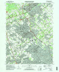
1995 Map of Telford
USGS Topo · Published 1996About this map
The East Branch Perkiomen Creek flows through a landscape of suburban growth and institutional heritage in this mid-1990s survey. The map details the dense residential clusters of Souderton and Telford, showing the concentration of educational and religious sites that defined these communities, from St Maria Goretti Sch to the North Ridge Bible Chapel. This period captures the region just as the Septa rail line and established corridors like Allentown Road supported increasing connectivity between Lansdale and the northern boroughs.
Find a feature on this map
122 named features on this map. Tap any name to fly to it.
Don’t see what you’re looking for? This feature index may not catch every label — zoom into the map to look around manually.
Map Details
Editions of this 1995 Telford Map
This is the sole edition of this map. No revisions or reprints were ever made.
Other maps of this area

1888 · Quakertown
USGS Topo · 1:62,500

1890 · Doylestown
USGS Topo · 1:62,500

1890 · Quakertown
USGS Topo · 1:62,500

1891 · Doylestown
USGS Topo · 1:62,500

1893 · Germantown
USGS Topo · 1:62,500

1894 · Quakertown
USGS Topo · 1:62,500

1894 · Norristown
USGS Topo · 1:62,500

1894 · Germantown
USGS Topo · 1:62,500

1895 · Norristown
USGS Topo · 1:62,500

1896 · Germantown
USGS Topo · 1:62,500