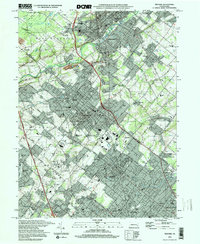
1997 Map of Telford
USGS Topo · Published 2000About this map
The East Branch Perkiomen Creek flows through a landscape defined by the historical growth of industrial boroughs and religious centers in the late twentieth century. Centered on Souderton and Telford, this survey shows a densely settled corridor along the Conrail line, where community landmarks like Grand View Hospital and numerous parochial institutions appear. The area's Pennsylvania German heritage is evident in the cluster of local meeting houses and schools, including the Schwenkfelder Ch and Little Zion Ch.
Find a feature on this map
76 named features on this map. Tap any name to fly to it.
Don’t see what you’re looking for? This feature index may not catch every label — zoom into the map to look around manually.
Map Details
Editions of this 1997 Telford Map
This is the sole edition of this map. No revisions or reprints were ever made.
Other maps of this area

1888 · Quakertown
USGS Topo · 1:62,500

1890 · Doylestown
USGS Topo · 1:62,500

1890 · Quakertown
USGS Topo · 1:62,500

1891 · Doylestown
USGS Topo · 1:62,500

1893 · Germantown
USGS Topo · 1:62,500

1894 · Quakertown
USGS Topo · 1:62,500

1894 · Norristown
USGS Topo · 1:62,500

1894 · Germantown
USGS Topo · 1:62,500

1895 · Norristown
USGS Topo · 1:62,500

1896 · Germantown
USGS Topo · 1:62,500