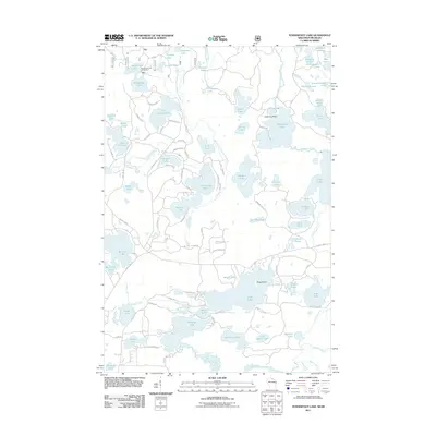
2011 Map of Tenderfoot Lake
USGS Topo · Published 2011About this map
Moosehead Lake Campground sits at the northern edge of a dense glacial lake district along the Wisconsin-Michigan border. This 2011 survey illustrates a landscape dominated by complex hydrology, where the East Branch Presque Isle River and Ontonagon River drain a network of named water bodies like Tenderfoot Lake and Kinwamakwad Lake. The transition from Michigan into Vilas County is marked by a shifting grid of forest service roads and local routes such as Rainbow Lodge Rd and Fishtrap Lake Rd. Notable landmarks like Killarney Point and Frog Island suggest a long-standing recreational culture centered on these shorelines. The intricate shoreline of Plum Lake and Sanborn Lake highlights the post-glacial topography that has historically shaped local land use and seasonal habitation in the Boulder Junction area.
Find a feature on this map
106 named features on this map. Tap any name to fly to it.
Don’t see what you’re looking for? This feature index may not catch every label — zoom into the map to look around manually.
Map Details
Editions of this 2011 Tenderfoot Lake Map
This is the sole edition of this map. No revisions or reprints were ever made.
Other maps of this area

1939 · Trout Lake
USGS Topo · 1:48,000

1946 · Star Lake
USGS Topo · 1:48,000

1946 · Trout Lake
USGS Topo · 1:48,000

1949 · Trout Lake
USGS Topo · 1:48,000

1950 · Star Lake
USGS Topo · 1:48,000

1952 · Thayer
USGS Topo · 1:62,500

1955 · Marenisco
USGS Topo · 1:62,500

1955 · Starlake
USGS Topo · 1:62,500

1955 · Boulder Junction
USGS Topo · 1:62,500

1958 · Iron River
USGS Topo · 1:250,000