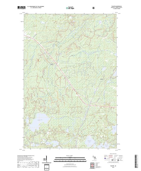
2023 Map of Thayer
USGS Topo · Published 2023About this map
The Ottawa National Forest dominates this northern Michigan landscape, where the Ontonagon Wild and Scenic River carves a path through dense woodland. Centered on the small settlement of Thayer, the geography is defined by a glacial lake district including Langford Lake, Spider Lake, and Clearwater Lake. The map reveals a complex network of forest trails and secondary roads such as the Deer Trail Grade and Old US Hwy 2, which indicate the area's transition from early logging routes to modern recreational use. Near Stickley and Stickley Lake, the presence of numerous small water bodies like Deeryard Lake and Hartley Lake highlights the marshy, hydrology-rich character of Gogebic County. This survey captures the region's balance between protected wilderness and the established clusters of rural dwellings that follow the local road network.
Find a feature on this map
88 named features on this map. Tap any name to fly to it.
Don’t see what you’re looking for? This feature index may not catch every label — zoom into the map to look around manually.
Map Details
Editions of this 2023 Thayer Map
This is the sole edition of this map. No revisions or reprints were ever made.
Other maps of this area

1939 · Trout Lake
USGS Topo · 1:48,000

1946 · Star Lake
USGS Topo · 1:48,000

1946 · Trout Lake
USGS Topo · 1:48,000

1949 · Trout Lake
USGS Topo · 1:48,000

1950 · Star Lake
USGS Topo · 1:48,000

1952 · Thayer
USGS Topo · 1:62,500

1955 · Marenisco
USGS Topo · 1:62,500

1955 · Starlake
USGS Topo · 1:62,500

1955 · Boulder Junction
USGS Topo · 1:62,500

1958 · Iron River
USGS Topo · 1:250,000