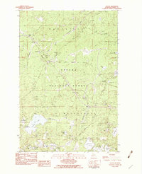
1982 Map of Thayer
USGS Topo · Published 1983About this map
Ottawa National Forest dominates this section of the Upper Peninsula, where the Chicago and North Western Railroad cuts through the woods of Marenisco Township and Watersmeet Township. Small rail-aligned settlements and stops like Gogebic Station, Blacks Spur, and Thayer represent the corridor's logistical history, while a dense network of water bodies defines the landscape. The northern portion is marked by the Ontonagon River and Kakabika Falls, while the southern reaches are filled with glacial lakes including Langford Lake, Cisco Lake, and Clearwater Lake. This 1980s field-checked survey preserves the spatial relationship between industrial infrastructure, such as the regional Pipeline, and the recreational landscape of campgrounds and boat ramps that evolved alongside the timber and rail routes.
Find a feature on this map
38 named features on this map. Tap any name to fly to it.
Don’t see what you’re looking for? This feature index may not catch every label — zoom into the map to look around manually.
Map Details
Editions of this 1982 Thayer Map
This is the sole edition of this map. No revisions or reprints were ever made.
Other maps of this area

1939 · Trout Lake
USGS Topo · 1:48,000

1946 · Star Lake
USGS Topo · 1:48,000

1946 · Trout Lake
USGS Topo · 1:48,000

1949 · Trout Lake
USGS Topo · 1:48,000

1950 · Star Lake
USGS Topo · 1:48,000

1952 · Thayer
USGS Topo · 1:62,500

1955 · Marenisco
USGS Topo · 1:62,500

1955 · Starlake
USGS Topo · 1:62,500

1955 · Boulder Junction
USGS Topo · 1:62,500

1958 · Iron River
USGS Topo · 1:250,000