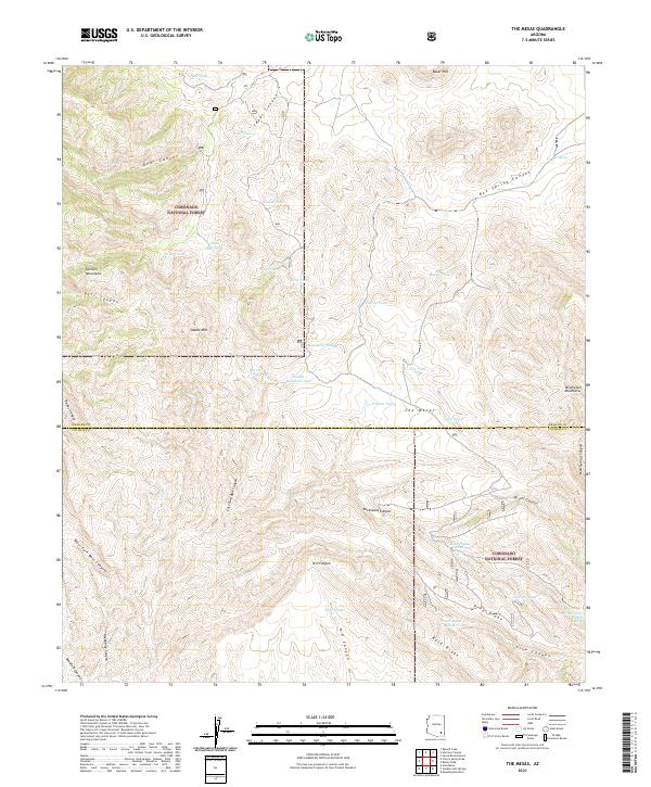
2021 Map of The Mesas
USGS Topo · Published 2021About this map
Coronado National Forest lands dominate this high-desert landscape along the border of Graham and Cochise counties. The terrain is defined by a series of dramatic canyons and ridges, including the eastern slopes of the Galiuro Mountains and the western reaches of the Winchester Mountains. Significant topographic features like Saddle Mtn, Bold Ridge, and Pine Ridge overlook a network of seasonal water sources essential for livestock and wildlife. These are represented by dozens of named tanks and springs, such as Rock House Tank, Eagle Tanks, and Poer Spring. This 2021 survey reveals a remote landscape where land use is still heavily influenced by the availability of water, with basins like The Mesas and canyons such as Bass Canyon and Redus Canyon serving as the primary geographic markers in this arid territory.
Find a feature on this map
50 named features on this map. Tap any name to fly to it.
Don’t see what you’re looking for? This feature index may not catch every label — zoom into the map to look around manually.
Map Details
Editions of this 2021 The Mesas Map
This is the sole edition of this map. No revisions or reprints were ever made.
Other maps of this area

1938 · Galiuro Mts
USGS Topo · 1:48,000

1940 · Sierra Bonita Ranch
USGS Topo · 1:62,500

1942 · Sierra Bonita Ranch
USGS Topo · 1:62,500

1943 · Galiuro Mts
USGS Topo · 1:62,500

1943 · Sierra Bonita Ranch
USGS Topo · 1:62,500

1943 · Winchester Mts.
USGS Topo · 1:62,500

1945 · Redington
USGS Topo · 1:62,500

1945 · Winchester Mts.
USGS Topo · 1:62,500

1956 · Tucson
USGS Topo · 1:250,000

1957 · Redington
USGS Topo · 1:62,500