2023 Map of Thoreau
USGS Topo · Published 2023About this map
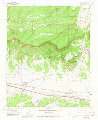
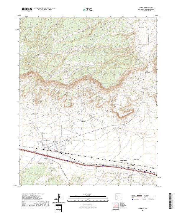
The community of Thoreau serves as the central hub of this McKinley County landscape, situated at a transition between the northern high ground of Mount Powell and the southern drainage of Mitchell Draw. The map details a residential grid including streets such as Red Rock Ave, Rose St, and Lilac St, alongside the Thoreau Cem. Transportation corridors define the local geography, with the Frontage Rd and various local routes like Largo's Corral Rd and Bluewater Rd providing access across the township lines. To the east, the settlement of Prewitt and the prominence of San Antonio Hill mark the edge of the survey area. Notable landmarks like San Antonio Spring highlight the critical water sources in this arid environment, while a network of Indian Service Routes facilitates movement through the surrounding hills.
Find a feature on this map
39 named features on this map. Tap any name to fly to it.
Don’t see what you’re looking for? This feature index may not catch every label — zoom into the map to look around manually.
Map Details
Editions of this 2023 Thoreau Map
This is the sole edition of this map. No revisions or reprints were ever made.