2022 Map of Thornton
USGS Topo · Published 2022About this map
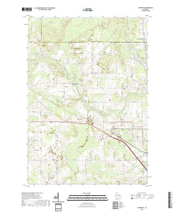
The Red River flows through the heart of this landscape, punctuated by a series of cascades including Freeman Falls, Gilmer Falls, and Little Bill Falls. The topography transitions from the winding river valley to the north, where the College of Menominee Nation - Keshena Campus sits near the Wolf River, to the more structured road networks surrounding the settlement of Thornton in the south. The area is defined by its water systems, with Kroenke Cr and Rose Brook draining the diverse terrain between the Menominee and Shawano county lines.
Find a feature on this map
75 named features on this map. Tap any name to fly to it.
Don’t see what you’re looking for? This feature index may not catch every label — zoom into the map to look around manually.
Map Details
Editions of this 2022 Thornton Map
This is the sole edition of this map. No revisions or reprints were ever made.