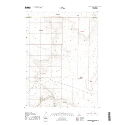
2018 Map of Thousand Creek Gorge
USGS Topo · Published 2018About this map
Thousand Creek Gorge cuts a deep path through the high desert of northern Humboldt County, where the Nevada-Oregon state line divides this remote landscape. The map details the drainage of Thousand Cr as it flows eastward between the Idaho Canyon Range and the prominent heights of McGhee Mtn. The transport pattern is defined by the Dufurrena Grade, which winds through the southern portion of the quadrangle, providing access to this high-altitude basin.
Find a feature on this map
18 named features on this map. Tap any name to fly to it.
Don’t see what you’re looking for? This feature index may not catch every label — zoom into the map to look around manually.
Map Details
Editions of this 2018 Thousand Creek Gorge Map
This is the sole edition of this map. No revisions or reprints were ever made.
Other maps of this area

1886 · Disaster
USGS Topo · 1:250,000

1889 · Long Valley
USGS Topo · 1:250,000

1893 · Disaster
USGS Topo · 1:250,000

1954 · Vya
USGS Topo · 1:250,000

1955 · Adel
USGS Topo · 1:250,000

1957 · Adel
USGS Topo · 1:250,000

1958 · Vya
USGS Topo · 1:250,000

1958 · Adel
USGS Topo · 1:250,000

1962 · Vya
USGS Topo · 1:250,000

1962 · Adel
USGS Topo · 1:250,000