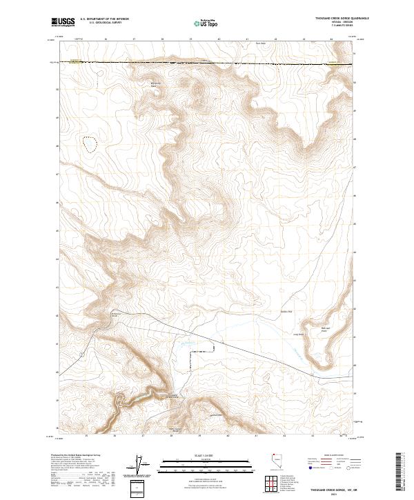
2021 Map of Thousand Creek Gorge
USGS Topo · Published 2021About this map
Thousand Creek Gorge forms the dramatic centerpiece of this high-desert landscape in northern Humboldt County. The terrain transitions from the broad expanses of Jackass Flat and Big Spring Table to the prominent heights of McGhee Mtn and the Idaho Canyon Range. The drainage of Thousand Cr winds through the central portion of the quadrangle, carving the deep gorge that serves as the region's defining geological feature. Local transportation is represented by the Dufurrena Grade, which traverses the varied topography near Long Draw. Located along the Nevada and Oregon border, this area reflects the character of the Great Basin's rugged northwestern corner, where isolated landmarks like Railroad Point and Twin Peak break the horizon. The map details the Township and Range system across these high-elevation flats and canyons, illustrating the enduring physical boundaries of the remote borderlands.
Find a feature on this map
18 named features on this map. Tap any name to fly to it.
Don’t see what you’re looking for? This feature index may not catch every label — zoom into the map to look around manually.
Map Details
Editions of this 2021 Thousand Creek Gorge Map
This is the sole edition of this map. No revisions or reprints were ever made.
Other maps of this area

1886 · Disaster
USGS Topo · 1:250,000

1889 · Long Valley
USGS Topo · 1:250,000

1893 · Disaster
USGS Topo · 1:250,000

1954 · Vya
USGS Topo · 1:250,000

1955 · Adel
USGS Topo · 1:250,000

1957 · Adel
USGS Topo · 1:250,000

1958 · Vya
USGS Topo · 1:250,000

1958 · Adel
USGS Topo · 1:250,000

1962 · Vya
USGS Topo · 1:250,000

1962 · Adel
USGS Topo · 1:250,000