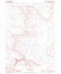
1990 Map of Thousand Creek Gorge
USGS Topo · Published 1990About this map
The Sheldon National Wildlife Refuge dominates this high-desert terrain where the Nevada and Oregon state lines meet. This landscape is defined by dramatic elevation changes, from the sheer walls of Thousand Creek Gorge to the broad expanses of Big Spring Table and Jackass Flat. Water sources are critical landmarks in this arid environment, represented by Big Spring and the winding course of Thousand Creek. Human presence is sparse but notable, centered around the Thousand Creek Ranch and Alder Creek Ranch, reflecting the region's enduring ranching heritage. Small-scale industrial activity is evidenced by a Quarry and a Prospect located near the base of McGee Mountain, while the northern edge of the map tracks the remote Harney and Humboldt county boundaries.
Find a feature on this map
19 named features on this map. Tap any name to fly to it.
Don’t see what you’re looking for? This feature index may not catch every label — zoom into the map to look around manually.
Map Details
Editions of this 1990 Thousand Creek Gorge Map
This is the sole edition of this map. No revisions or reprints were ever made.
Other maps of this area

1886 · Disaster
USGS Topo · 1:250,000

1889 · Long Valley
USGS Topo · 1:250,000

1893 · Disaster
USGS Topo · 1:250,000

1954 · Vya
USGS Topo · 1:250,000

1955 · Adel
USGS Topo · 1:250,000

1957 · Adel
USGS Topo · 1:250,000

1958 · Vya
USGS Topo · 1:250,000

1958 · Adel
USGS Topo · 1:250,000

1962 · Vya
USGS Topo · 1:250,000

1962 · Adel
USGS Topo · 1:250,000